Chicago Riverwalk — South Branch
Building on the success of the Main Branch Chicago Riverwalk, the Chicago Department of Transportation asked the design team to study the opportunities and challenges of extending a continuous river-level path from Lake Street to Ping Tom Memorial Park; approximately ~2 miles. Key differences, such as land ownership and physical conditions, make this ambitious project an effort of both visioning and coordination.
The design approach for the South Branch Riverwalk Implementation Plan considers four environmental systems: river edge developments, vertical access, underbridge conditions, and programmatic distribution. A cohesive palette of recommended elements was established for each of the first two systems, and a unifying single design concept was proposed for underbridge connections at all bridge locations.
The South Branch Riverwalk Implementation Plan illustrates the compelling opportunity an extension of the Main Branch Riverwalk provides while creating a roadmap for coordination between the public and private sectors. When deployed, the project will forever enhance the urban landscape and civic assets of Chicago.
Client: Chicago Department of Transportation
Program: Linear park along the South Branch of the Chicago River
Size: 2 miles
Cost: $375,850,000 (conceptual estimate)
Role: Architect and Landscape Architect
Collaborative Partners:
AECOM (Lead Consultant and Engineer)
Site Design Group (Landscape Architect)
Environmental Design International (Civil Engineer)
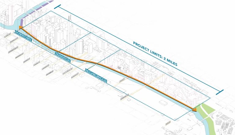
The planning process began with data collection, analysis of existing conditions and an inventory of adjacent properties along the east side of the River, the focus area of a proposed extension. Key constituents and collaborators included the Metropolitan Planning Council, Friends of the Chicago River, Active Transportation Alliance, Department of Planning and Development, Chicago Park District, and Fleet and Facility Management.

West Lake Street to West Monroe Street © Google Earth
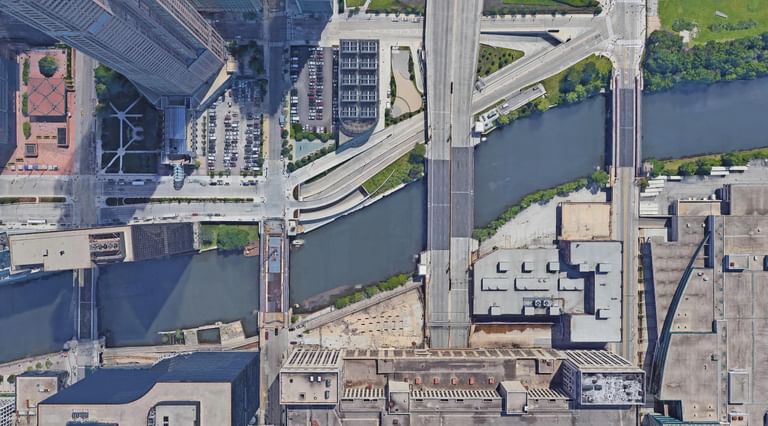
West Jackson Boulevard to West Harrison Street © Google Earth
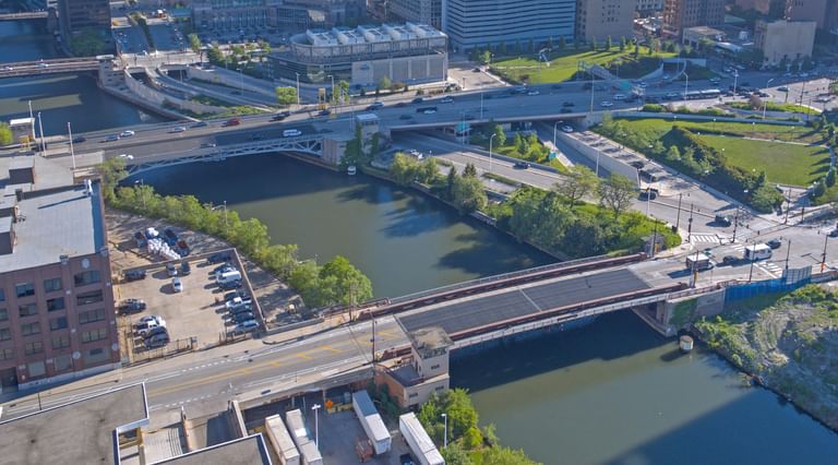
West Ida B. Wells. Drive to West Harrison Street Aerial
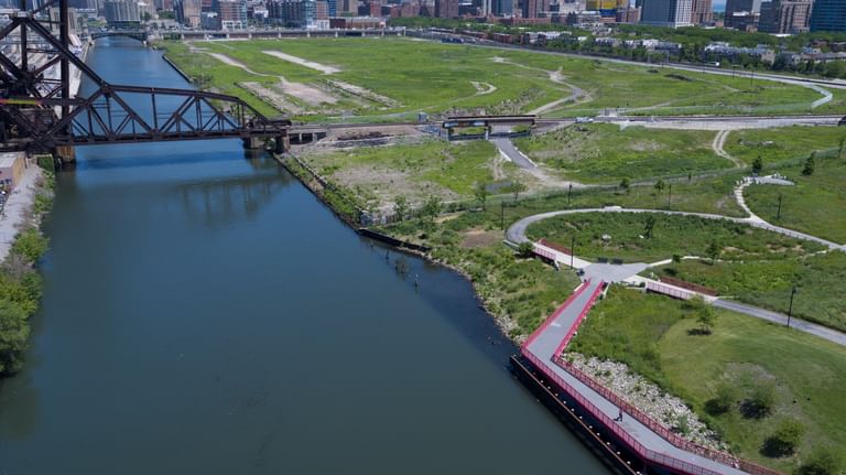
Aerial view of Ping Tom Memorial Park and "the 78"
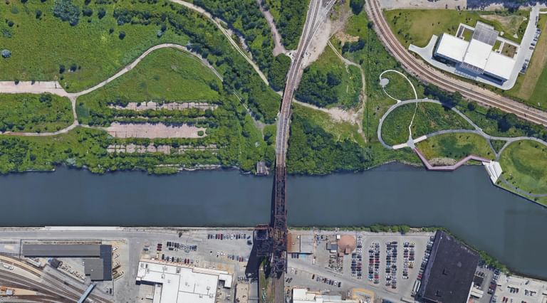
St. Charles Air Line Bride (approximately 16th Street) © Google Earth

River level view looking north toward "the 78"
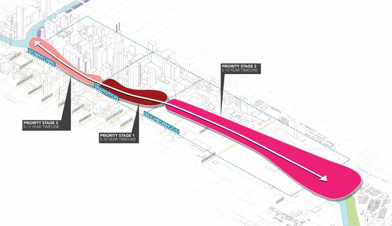
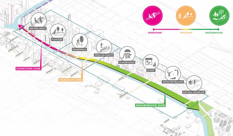
The distinct nature of the South Branch of the Chicago River shaped opportunities for placemaking and informed the creation of three sections:
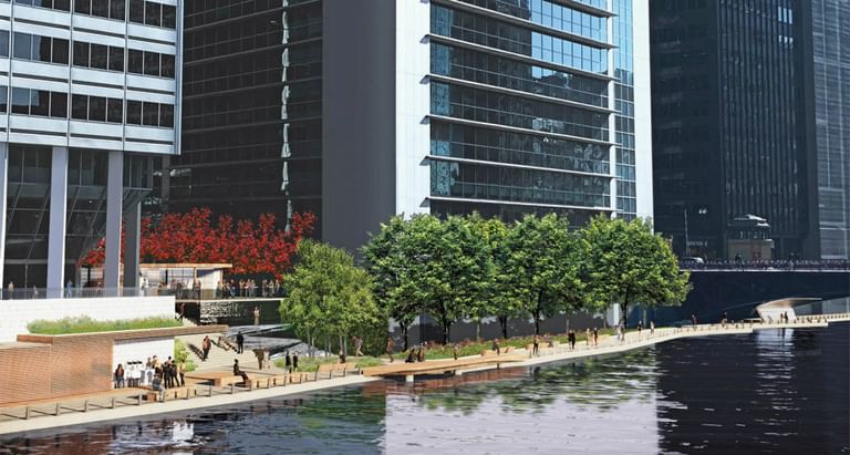
Downtown - the continuous wall of tall buildings create a river canyon (many buildings lie flush to the River’s edge) with heavy pedestrian traffic crossing the River to access transit stations and the bustling West Loop.
Transition — the city fabric opens up and exchanges tall buildings for a spaghetti network of roadways, including Ida B. Wells Drive (formerly Congress Parkway).
Neighborhood — new and existing developments in the South Loop, such as the 78, Southbank, and River City, form the backbone of a thriving residential community. The south end of the project terminates at Ping Tom Memorial Park; a large anchor for Chicago’s Chinatown.
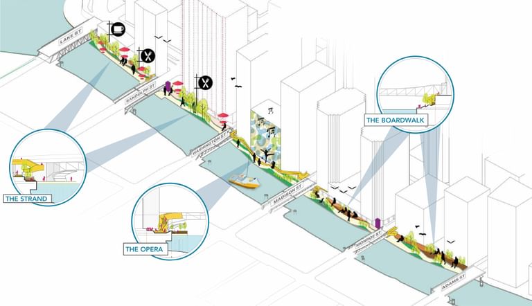
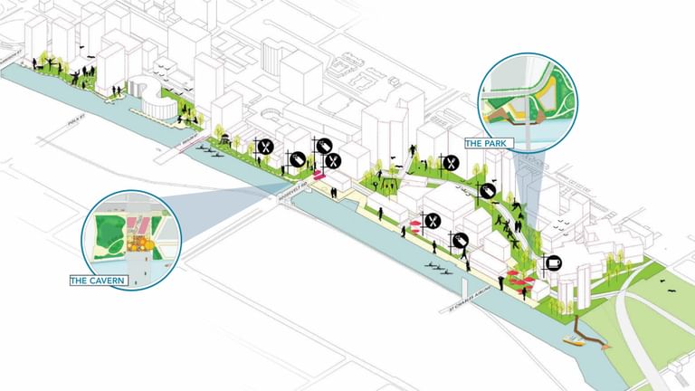
The design strategy looked across the 2 mile length of riverfront to define a series of urban “rooms” that programmatically spring to life and pull people to the river’s edge.
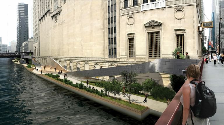
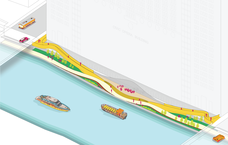
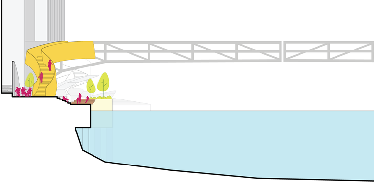
Harkening upon the grandeur of a historic opera-style staircase, “The Opera” room introduces a new space for cultural engagement along the South Branch. An elegant serpentine stair descends from an overlook at the adjoining streets: West Washington and West Madison Streets. A river-level platform, centered in the space, can be used for sculptures, artistic programming, and performances; viewable from tiered seating, the adjacent bridges, and Riverside Plaza on the west bank. The city becomes the audience with the Riverwalk taking center stage.
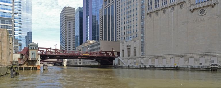
Existing Condition

Conceived as a grand entry to the neighborhood zone of the Implementation Plan, “The Waterfall” is an interpretation of the River Theatre on the Main Branch Chicago Riverwalk. It melds circulation, leasable spaces, and natural elements to create a tranquil and memorable space.
An ADA accessible ramp intertwines among stairs and seating steps. Three linear fountains cascade water down the steps and terminate at floating gardens along the river edge, contributing to the cleaning of the river and increasing habitat for aquatic life.
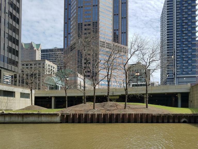
Existing Condition
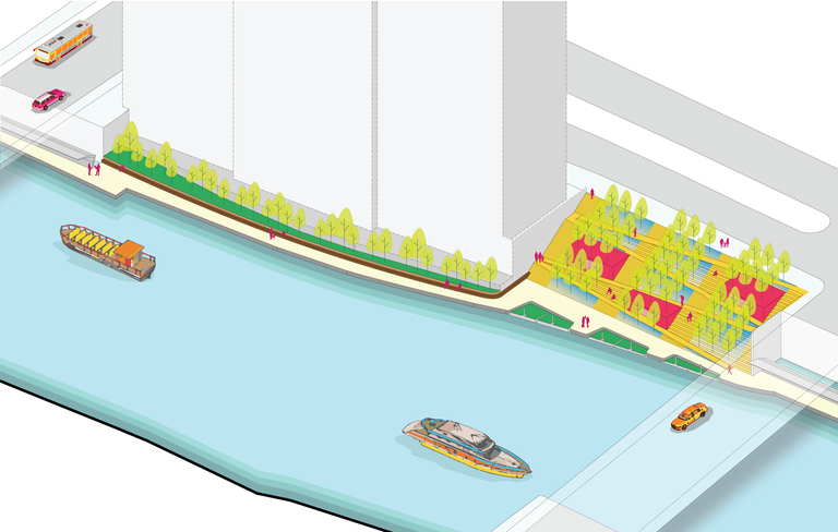
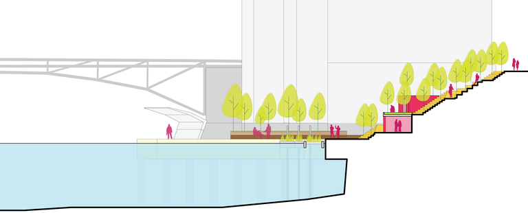
Collaborating closely with Volpe, the National Transportation Systems Center (the research arm of the United States Department of Transportation) the design team assisted in the development of a current and project vessel traffic analysis. The Chicago River remains an active economic resource for the City of Chicago and any modifications to its functional width could generate impacts. This early analysis included additional collaboration with the U.S. Army Corps of Engineers and the U.S. Coast Guard, resulting in a series of design parameters and policy recommendations.

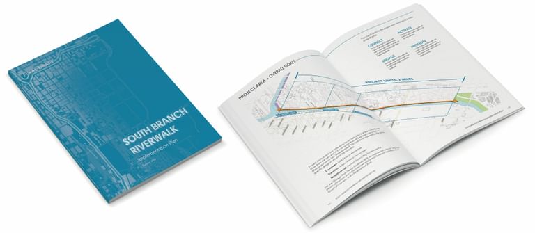
The South Branch Riverwalk Implementation Plan cataloged existing conditions, technical requirements, a cohesive design vision, projected costs, and phasing. The 2‑mile stretch was split into three priority stage areas with work taking place over 5 – 15 years.
Priority Stage 1 — This stage serves as a bridge between the downtown core and the burgeoning South Loop. Because it includes pockets of City-owned and managed parcels, this stage has the potential to be more easily implemented.
Priority Stage 2 — Current development plans provide a continuous multi-use path as part of the publicly accessible setback space within each development. Connections between developments would likely become the responsibility of the City. These underbridge connections are critical to the success of a continuous path at river level.
Priority Stage 3 — River access in this stage varies widely with some privately owned buildings featuring narrow riverside plazas while others have facades extending directly down to the channel bed. Each block, sometimes with multiple building owners, may have unique challenges to overcome in achieving a cohesive design and implementation.
